|
|
Habitat Suitability and Multifunctional Landscapes
Project Contact
Project Summary
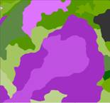
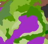
This project is investigating biodiversity within the wider landscape by integrating habitat information with patterns of land-use, and then exploring potential scenarios of change. Our aim is to investigate the multiple functions that landscapes provide and thereby assimilate schemes that enhance biodiversity together with key natural, cultural and economic factors. Ultimately, this will provide a platform for an integrated assessment of ecosystem services.
A key tool for exploring dynamic land-use change will be the LandSFACTS model (Castellazzi et al, 2007), which can generate multiple scenario options based upon certain constraints. Currently, the system has been developed to simulate cropping patterns in the landscape but we propose to extend this to include habitats and other land uses. We are also integrating other potential influences such as climate, land capability and ownership (cultural issues).
The project features two pieces of work running in parallel:
- Based on current Scottish land-uses, assess the broad habitat mosaic and its connectivity to support biodiversity. The approach will further develop and evaluate concepts of landscape cohesion and permeability (McGarigal, 2002; Opdam et al, 2003; Zebisch et al, 2004).
- Develop a generic multi-functional landscape modelling tool for agro-ecosystems and woodland habitats to evaluate additional landscape functionalities (e.g. recreation, food resources). This work will build on both LandSFACTS and previous work at the Macaualy Institute (Gimona and van der Horst, 2007).
We will draw on empirical evidence from both other modules in WP3.8 and other workpackages (especially 3.1 and 3.7) to calibrate the model and analyse scenario outcomes.
References:
- Castellazzi, M.S., Matthews, J., Wood, G.A., Burgess, P.J., Conrad, K.F., and Perry, J.N. 2007. LandSFACTS: Software for Spatio-temporal Allocation of Crops to Fields. Proceedings of 5th Annual Conference of the European Federation of IT in Agriculture, Glasgow, UK.
- Gimona, A. and van der Horst, D. 2007. Mapping hotspots of multiple landscape functions: a case study on farmland afforestation in Scotland. Landscape Ecology 22 (8), 1255-1264.
- McGarigal, K. 2002. Landscape pattern metrics. in Encyclopedia of Environmentrics, volume 2. El-Shaarawi, A. H. and Piegorsch, W. W. eds., John Wiley & Sons, Sussex, England. pp.1135-1142.
- Opdam, P., Verboom, J., and Pouwels, R. 2003. Landscape cohesion: an index for the conservation potential of landscapes for biodiversity. Landscape Ecology. 18 (2), 113-126.
- Zebisch, M., Wechsung, F., and Kenneweg, H. 2004. Landscape response functions for biodiversity--assessing the impact of land-use changes at the county level. Landscape and Urban Planning. 67 (1-4), 157-172.
|
|
 This site is hosted by The James Hutton Institute